Category: Local Project Listing 2020

Read more

Inner Sunset Streetscape Improvements & Muni Forward

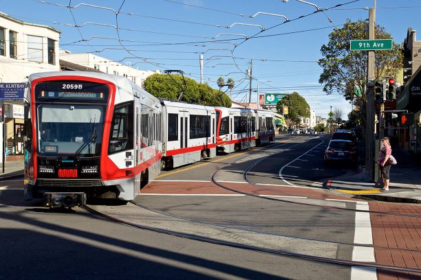
Location Irving St and 9th Ave City or County Responsible for Project San Francisco Author Denny Phan Organization San Francisco Public Works Address 30 Van Ness Ave, 5th Floor Phone 628-224-2232 Project Description Irving St is an active two-lane commercial corridor in the heart of the Inner Sunset neighborhood. It is home to approximately 19,000 residents and includes the main campus of UCSF and the gateway into Golden Gate Park. The N-Judah light rail train runs along the center of the street serving the City’s busiest line with a daily average of 50,000 riders. The project was conceived as a small transit improvement project to construct four large bulbouts to serve as dedicated transit stops with full-scale pedestrian safety improvements, landscape beautification elements, and seating for transit riders and local businesses to make the street more livable, vibrant, and sustainable. However, since the project planned to already impact the neighborhood, […]

Read more

Pavement Management Program

Location Cupertino, Various Locations City or County Responsible for Project City of Cupertino Category Roads: Efficient and Sustainable Road Maintenance, Construction and Reconstruction Projects. Author Roger Lee Organization City of Cupertino Address 10300 Torre Ave Phone 408-777-3354 Project Description Cupertino’s street network consists of approximately 138 centerline miles and is one of the City’s most valued assets. Like many other Cities, Cupertino’s Pavement Maintenance funding decreased during challenging economic times. By 2013, the average PCI had declined to 64. With an improved economy, it became clear the City needed to invest in its aging street infrastructure, as deferring maintenance would only lead to more costly repairs in the future. As a result, the City Implemented an aggressive Pavement Management Program which set a performance measures to achieve a system wide PCI of 82 or greater. Between 2013 and 2018, the City repaired or maintained approximately 653 street segments, installed 900 […]

Read more

North Sanborn Road Safety Improvement Project

Location North Sanborn Road (from East Alisal Street to Freedom Parkway) -10 intersections City or County Responsible for Project Salinas Category Safety or Intelligent Transportation System Projects Author Victor Gutierrez Organization City of Salinas Address 200 Lincoln Avenue Phone 831-758-7241 Project Description North Sanborn Road, between East Alisal Street and Freedom Parkway, was identified as a road segment with heavy pedestrian activity and a high number of rear-end collisions, broadsides and collisions that involved pedestrians and/or bicyclists. The City of Salinas successfully received funding from the California Highway Safety Improvement Program (HSIP) to make improvements along North Sanborn Road, between East Alisal and Freedom Parkway, to address the need for safety and efficiency along this corridor. The corridor is in East Salinas, a low-income area in the City which has high pedestrian and transit/bus activity along the route to various schools (elementary, middle and high schools). The North Sanborn Road […]

Warnerville Road Rehabilitation

Location Between Tim Bell Road and Crabtree Road in unincorporated Stanislaus County City or County Responsible for Project Stanislaus County Category Roads: Efficient and Sustainable Road Maintenance, Construction and Reconstruction Projects. Author David Leamon Organization Stanislaus County Address 1716 Morgan Road Phone 2095254151 Project Description With a new funding source of Senate Bill 1 gas tax funds becoming available in 2017, the County’s Public Works team began brainstorming on long term, sustainable and innovative solutions to resolve the historically poor road conditions on the eastern portion of Warnerville Road. The targeted segment of Warnerville Road is located in eastern rural Stanislaus County and was made up of stretches of asphalt pavement, gravel, and native non-draining soils. This 5.4 mile segment of road is primarily utilized as an agricultural haul road for various agricultural products such as tree nuts and wine grapes. During harvest periods, the roads sees heavy truck loads […]

Read more

San Jacinto Trails Master Plan

Location Citywide City or County Responsible for Project City of San Jacinto Category Complete Streets Projects Author Rene Yarnall Organization City of San Jacinto Address 595 S San Jacinto Ave Phone 9514877330 Project Description The San Jacinto Trails Master Plan (SJTMP) is a comprehensive planning document that provides a strategic framework for the future development of a fully connected, multi-use, non-motorized trails network. The plan summarizes the City’s existing trail and multi-modal conditions to develop project recommendations that make multi-modal transportation safe and an enjoyable option. The plan strongly promotes public health through active transportation, street safety, environmental health and more. The plan aligns with regional non-motorized transportation plans and addresses sustainable community planning goals and objectives. What is unique and exemplary of the SJTMP is that its focus and priority was to establish a network of Class 1 multi-use trails, which are widely considered the safest and most comfortable […]

Read more

North Fremont Bike and Pedestrian Access and Safety Improvements Project

Location North Fremont Street, Monterey, CA City or County Responsible for Project City of Monterey Category Complete Streets Projects Author Andrea Renny Organization City of Monterey Address 580 Pacific Street Phone 831-646-3705 Project Description The North Fremont Bike and Pedestrian Access and Safety Improvements Project transformed North Fremont Street in the City of Monterey (City) into a true multi-modal corridor, providing safe access to bicyclists and pedestrians on a vital link between residential, commercial, educational, and community facilities. This project is the first major transportation project to occur along North Fremont Street in over fifty years. Construction of this $9.4 million project involved included the construction of the first Class IV-protected bicycle lanes adjacent to the median with bicycle signals and bike-protected intersections in California. This design is aimed at users of all ages and abilities. This project promotes a safe alternative to driving on a corridor that carries an […]

Read more

Live Oak Canyon Road and Trabuco Canyon Road Highway Safety Improvements

Location Live Oak Canyon Road, Trabuco Canyon Road (near El Toro Road) City or County Responsible for Project County of Orange Category Safety or Intelligent Transportation System Projects Author Regina Hu Organization County of Orange, Public Works Address 601 N. Ross St, Santa Ana, CA 92703 Phone 714-647-3927 Project Description Live Oak Canyon Road and Trabuco Canyon Road are two-lane rural, windy, canyon roadways within unincorporated County of Orange, known for its series of vertical and horizontal curves with limited recovery areas for errant vehicles. In fact, the sharp curvatures and tree canopy have been featured in commercials and cinema to showcase the handling of sports cars. But for typical drivers, within a 10-year span between January 2002 and January 2012, there were 245 collisions and several fatalities within the project limits. These collisions could be counter-measured with improvements compatible with a rural roadway, making this 3-mile project an ideal […]

Read more

Yount Street Rehabilitation Project-MT3020

Location Yount Street from Washington Street to Mount Street City or County Responsible for Project Town of Yountville Category Roads: Efficient and Sustainable Road Maintenance, Construction and Reconstruction Projects. Author Joe Tagliaboschi Organization Town of Yountville Address 6550 Yount Street Phone 707.944.8851 Project Description Yount Street was reconstructed using the Full Depth Reclamation technique. This process was arrived at after extensive testing and analysis and recommendation by our consultant Pavement Engineering Inc. The Town of Yountville uses Full Depth Reclamation (FDR) as the preferred method for street reconstruction as this is the fifth street in as many years to undergo this process. This is an innovative process that saves time, material, and money while reducing the carbon footprint when compared to traditional paving reconstruction processes. FDR is a beneficial process as the existing pavement is pulverized and cement ( and lime) are added to stabilize the sub base. The FDR […]

Read more

Bayside Drive, Jamboree Road/Marine Avenue

Location Bayside Drive (from PCH to Jamboree); Jamboree Avenue (from PCH to North Bay Front) City or County Responsible for Project City of Newport Beach Category Roads: Efficient and Sustainable Road Maintenance, Construction and Reconstruction Projects. Author Dave Webb Organization City of Newport Beach-Public Works Address 100 Civic Center Drive Phone 949-644-3330 Project Description Bayside Drive and Jamboree Road/Marine Avenue Improvements project was a multi-purpose endeavor designed to provide traffic calming measures, beautification, and sustainability along the high volume corridor. Bayside Drive is a heavily traveled thoroughfare that provides the main access to multiple neighborhoods, a retail center, and Balboa Island. A portion of Bayside Drive is located at the busy intersection/entrance to Balboa Island. For context, Balboa Island is home to many residents and also a popular tourist destination. Aside from the ferry, the Bayside Drive corridor serves as the only vehicular entrance to the island. Due to the […]

Read more

Foothill Crossing Project

Location Foothill Boulevard and Ferrini Road City or County Responsible for Project City of San Luis Obispo Category Safety or Intelligent Transportation System Projects Author Andrew Harris Organization City of San Luis Obispo Address 919 Palm Street, San Luis Obispo, CA 93401 Phone 805-783-7857 Project Description On December 18th, 2019 The City of San Luis Obispo, California, activated the very first Pedestrian Hybrid Beacon (PHB) or HAWK Beacon intersection in the County of San Luis Obispo at the intersection of Foothill Boulevard and Ferrini Road. A PHB is a traffic control device used to stop road traffic and allow pedestrians and bicyclists to cross safely. They are often used to improve crossings of major streets in locations where conditions do not warrant installation of a full traffic signal. For pedestrians and bicyclists, a PHB provides a similar crossing experience to a conventional traffic signal, with less disruption to vehicle traffic […]

Account details will be confirmed via email.