Category: Nominations

Read more

Central Avenue Safety Improvement Project

  Location City of Alameda City or County Responsible for Project City of Alameda as lead agency (and Caltrans partnership – partially on State Highway 61) Category Complete Streets Projects Description The $22 million project, which will start construction this summer, includes a road diet with two motor vehicle travel lanes, a two-way left-turn lane as a center lane, bikeways, three roundabouts at 1) Main/Pacific/Central; 2) Third/Taylor/Central; 3) Fourth/Ballena/Central, resurfacing, improved bus stops, enhanced pedestrian crossings and street trees/bio-retention areas. Project submitted by Name Gail Payne Job Title Project Manager Organization City of Alameda Address 2263 Santa Clara Avenue, Rm 130, Alameda, CA 94501 Email gpayne@alamedaca.gov Phone 5107476892

Read more

166th Street Improvement Plans

  Location 166th Street between Pioneer Boulevard and Norwalk Boulevard City or County Responsible for Project City of Artesia Category Complete Streets Projects Description The City of Artesia is committed to sustainable transportation and has recently completed a road diet and installed green stripe bike lanes on 166th Street between Pioneer Boulevard and Norwalk Boulevard as part of the 166th Improvement Plans. This improvement encourage a shift from automobiles by making walking and biking safer in this neighborhood. This project was done in partnership with the cities of Norwalk and Cerritos as they jointly own segments of the street. The area that 166th Street is located in the City is densely populated and identified as a disadvantaged community on several state indicators. The total project area is approximately 2,880 linear feet and includes the southern portion of 166th Street from Pioneer Boulevard to Horst Avenue in the City of Artesia, […]

Read more

Ord Terrace Elementary School Crossing Improvements Project

  Location 1775 La Salle Avenue, Seaside CA 93955 City or County Responsible for Project City of Seaside Category Safety or Intelligent Transportation System Projects Description The City of Seaside is committed to developing Safe Routes to School for the children of Seaside. Ord Terrace Elementary School (School), a public school located at 1775 La Salle Avenue, serves over 400 students in Kindergarten through 6th grade in the City. The Ord Terrace Elementary School Crossing Improvement Project (Project) was a traffic-calming project to benefit the families and staff of the School by improving an important route to school. Prior to the implementation of the Project, heavy traffic and parking congestion were experienced during the morning and afternoon drop-off and pick-up periods. The prior crosswalk located across La Salle Avenue was less visible to vehicles as were the crosswalk signs which added to the safety issues students faced when crossing at […]

Read more

Accelerating Street Repairs

  Location City-wide City or County Responsible for Project Downey Category Roads: Efficient and Sustainable Road Maintenance, Construction and Reconstruction Projects. Description The City of Downey owns and maintains 214 miles of roadways, consisting of 154 miles of residential streets (which make up 80% of the City’s street network), 17 miles of collectors and 43 miles of arterial highways. In March 2021, the City Council adopted the City’s Pavement Management Program (PMP) Update. A PMP provides a systematic approach to assessing, monitoring and managing the condition of highway pavements in the most cost-effective manner. The results of the study help determine the most appropriate pavement rehabilitation strategies, prioritize locations and form the basis of the City’s 10-year street improvement program. In July 2021, the City Council wanted to accelerate much needed street improvements, and adopted a program that would issue approximately $30.5 million in bonds and make payments on these […]

Read more

I-405 Widening Design and Construction Support Services

  Location Not applicable City or County Responsible for Project City of Fountain Valley Category Roads: Efficient and Sustainable Road Maintenance, Construction and Reconstruction Projects. Description The Orange County Transportation Authority (OCTA), in cooperation with the California Department of Transportation (Caltrans), improved the mainline freeway and interchanges on Interstate 405 in Orange and Los Angeles counties. The project relieves congestion and improves operational efficiency on I-405 between State Route 73 (SR-73) and Interstate 605 (I-605) and the city streets in the City of Fountain Valley. The overall construction value of the project was $1.5 billion and work was completed in five years, with the ribbon cutting celebration taking place on December 1, 2023. This design-build project significantly improves traffic movement, reduces congestion-related accidents, and improves traffic flow within the City of Fountain Valley. Seven bridges at Ward Street, Talbert Avenue, Brookhurst Street, Slater Avenue, Bushard Street, Warner Street, and Magnolia […]

Read more

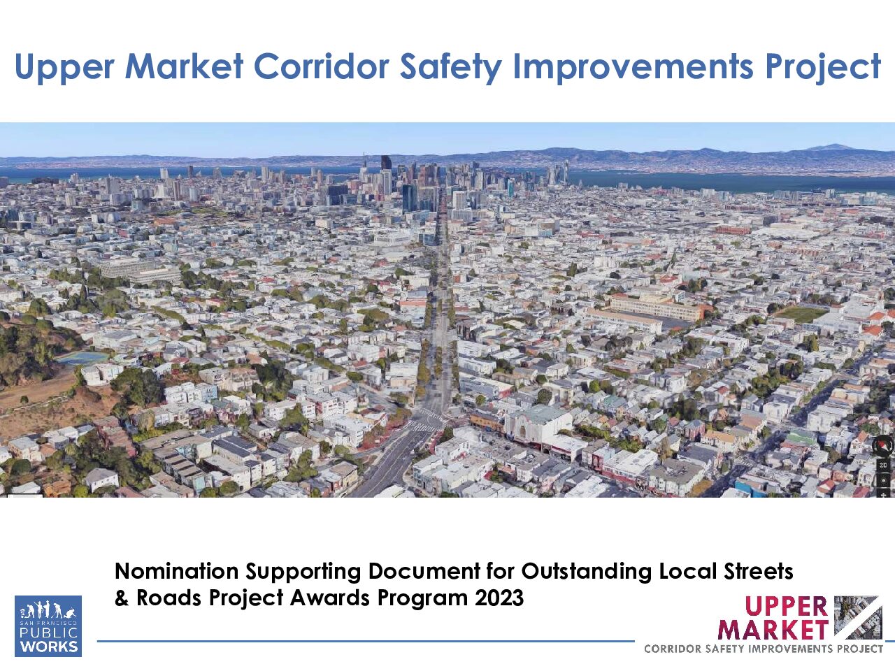
Upper Market Corridor Safety Improvements Project

  Location Market St: Castro St to Octavia St/US-101 Highway and Guerrero St: Market St to Duboce Ave City or County Responsible for Project San Francisco Category Complete Streets Projects Description Upper Market Corridor is a multi-functional thoroughfare with heavy usage from pedestrians, bicyclists, public transportation riders, and vehicular usage in San Francisco, CA. The Upper Market corridor connects the historic Castro district from Market Street/Castro Street to Octavia Street/US-101 Highway for approximately 1 mile. The project also included Guerrero Street from Market Street to Duboce Avenue. This busy Market Street segment has unique intersections that have 6 streets intersecting leaving wide roadway space for vehicles. To beautify the corridor and promote safety to align with Vision Zero SF (aiming to eliminate all traffic deaths in San Francisco by 2024), approximately $10 Million was spent overall for the project using local funding (IPIC-Interagency Plan Implementation Committee). During planning phase, community […]

Read more

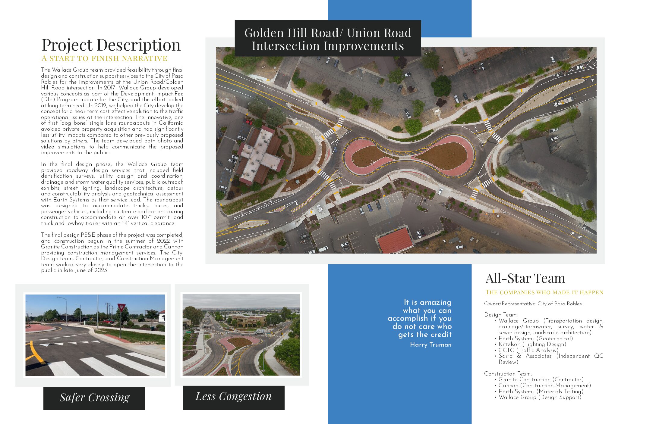
Golden Hill Road/ Union Road Intersection Improvements

  Location Golden Hill Road/ Union Road City or County Responsible for Project City of Paso Robles Category Roads: Efficient and Sustainable Road Maintenance, Construction and Reconstruction Projects. Description The Golden Hill Road/Union Road intersection was known as the “worst intersection in town.” Constrained by existing development the highly skewed stop-controlled intersection caused driver confusion resulting in congestion and limiting accessibility for pedestrians and bicyclists. For years the City of Paso Robles evaluated potential improvements such as signalization, realignment, and a multilane roundabout; however, all options required extensive property acquisition and eventually stalled. The City then sought the expertise of the Wallace Group team to devise an innovative solution. The outcome of our team’s efforts was a “dog bone” shaped roundabout—the first of its kind in the region—that avoided private property acquisition by limiting the roadway footprint to be within the existing paved area. CCTC analyzed the single lane roundabout […]

Account details will be confirmed via email.