Green Tree Boulevard Extension
Location
Hesperia Road & Ridgecrest Road
City or County Responsible for Project
City of Victorville
Category
Bridge: Efficient and Sustainable Bridge Maintenance, Construction and Reconstruction Projects
Description
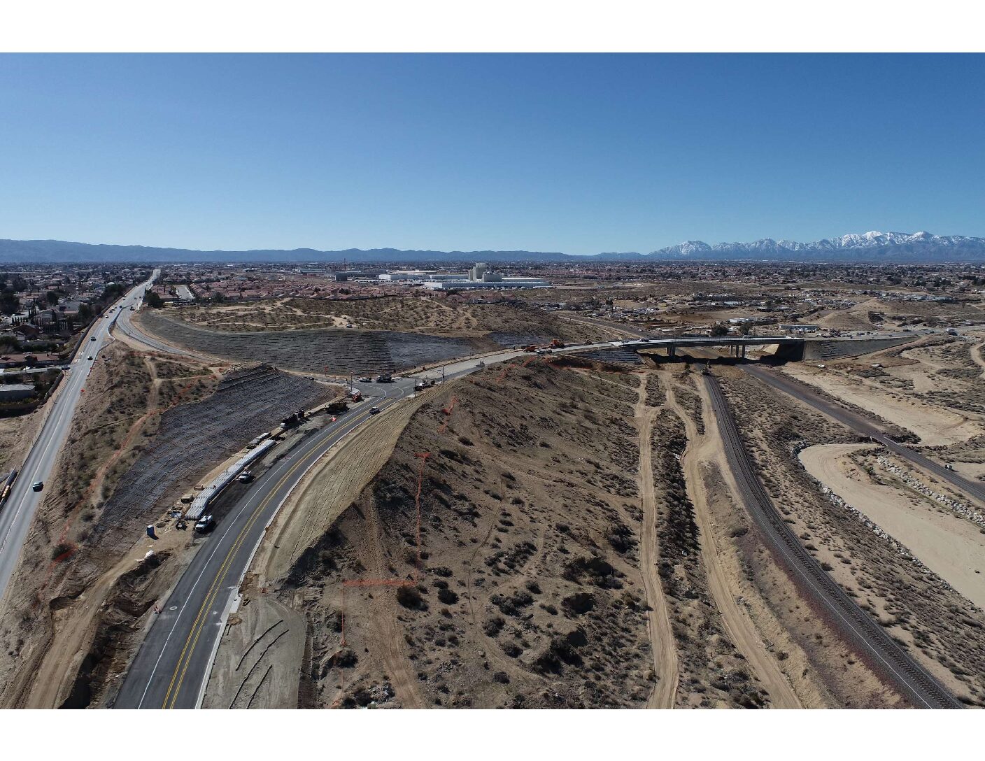
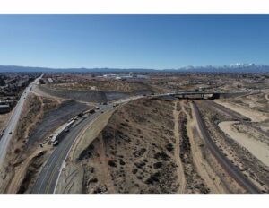
In collaboration with the Town of Apple Valley (“Town”) and County of San Bernardino (“County”), the City of Victorville (“City”) completed a multijurisdictional connectivity project providing a third alternate thoroughfare crossing the Burlington Northern Santa Fe Railroad and Mojave River bisecting the tri-community area. Termed the “Green Tree Boulevard Extension Project” (“Project”), it was the final phase in a three phased corridor project to join Yucca Loma Road in the Town to Yates Road in the County to Green Tree Boulevard in the City. Prior to Project completion, east-west movements across the railroad and river were limited to Hwy 18 and Bear Valley Road situated at the north and south ends of the City resulting in severe congestion, poor levels of service and extended commute times. The Project was completed in June 2023 for approximately $47 million. Funding sources included Federal, City, Town, County and San Bernardino County Transportation Authority (“SBCTA”) contributions.
The phased projects required an integrated design of existing and new improvements to seamlessly join the three communities together which were engineered by Dokken Engineering. This Project constructed 1.5 miles of roadway from Yates Road to Hesperia Road including seven miles of bike lanes connecting the Mojave Riverwalk to the Hesperia Road and 7th Street biking networks. A re-alignment and widening of Ridgecrest Road to T-intersect with Green Tree Boulevard was included in the scope of work. Other project features included a bridge, box culvert, traffic signals, water quality basin, sewer, storm drain systems and public utility systems.
Over a decade of work involving a tremendous amount of collaboration and planning was required between the consultant, agencies, utilities, railroad and environmental jurisdictions. A total of 19 parcels were affected, including 11 fee takes, 9 road easements, 13 slope easements, 3 drainage easements, 10 temporary construction easements, and multiple utility relocations. Due to funding constraints, interim project features were designed with the ultimate project configuration in mind to minimize future re-work. The Project site was graded for ultimate conditions to avoid the need for additional private property acquisitions and environmental mitigation in the future. Traffic signal equipment, utilities, and drainage features were placed to avoid conflicts with deferred ultimate improvements. Storm drains, culverts, inlets, and the water quality basin were designed and constructed to accommodate ultimate flows and storage.
Integral to the Project is the 580-ft long bridge crossing the BNSF Railroad and Santa Fe Wash, the largest bridge in the City of Victorville. The bridge structure design and construction presented challenges. BNSF required a bridge span configuration to avoid column placement in conflict with future track expansion and bents outside their right of way. With the presence of the Santa Fe Wash adjacent to the tracks, clear spanning the BNSF right of way was not feasible. The end result included a 228-foot main span over the existing tracks with room for future rail expansion but with one bent of columns constructed within an easement in the BNSF right of way. The bridge was constructed to ultimate width, including bike lanes and protected sidewalks.
Several permits were required from ACOE, CDFW, and RWQCB for the phased projects. Due to temporary and permanent impacts to the local environment, mitigation measures were required to meet environmental commitments. The City, in coordination with the Town and County, invested in a 16.7-acre habitat restoration site within the Mojave River area adjacent to the projects. The habitat restoration area exceeded minimum success criteria set forth by the regulatory agencies for survival of native vegetation and percent cover of non-native species.
The completed projects benefit the tri-community area bring together an east/west corridor as a travel alternative by connecting the Town, County and City. This capstone Project provided the final connection, reducing trip times by up to 15 minutes from the additional access to retail markets, jobs, healthcare, and other necessary services given. The congestion relief of the other overhead crossings of Bear Valley Road and Hwy 18 used by the communities have resulted in an increased level of service by reducing trip times and associated lower emissions.
Project submitted by
Name
Fredy Bonilla
Job Title
City Engineer
Organization
City of Victorville
Address
14343 Civic Drive, Victorville, CA 92392
fbonilla@victorvilleca.gov
Phone
7609555170