Mansell Streetscape Improvement Project
Location
Mansell Street from Dublin St to University St
City or County Responsible for Project
San Francisco
Category
Complete Streets Projects
Author
David Froehlich
San Francisco Public Works
30 Van Ness Ave, 5th Floor, San Francisco, CA 94102
415-558-4041
Project Description
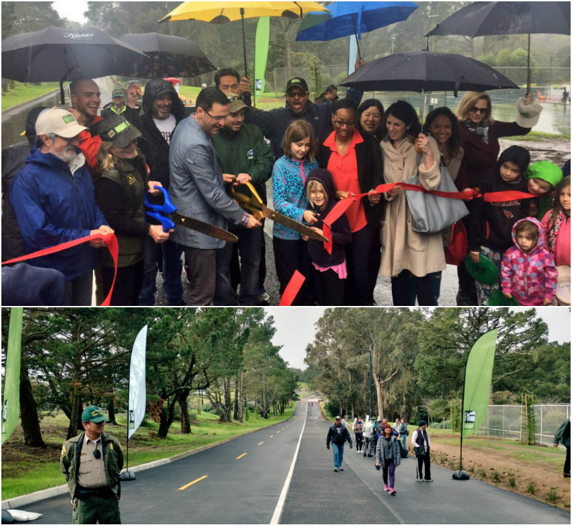
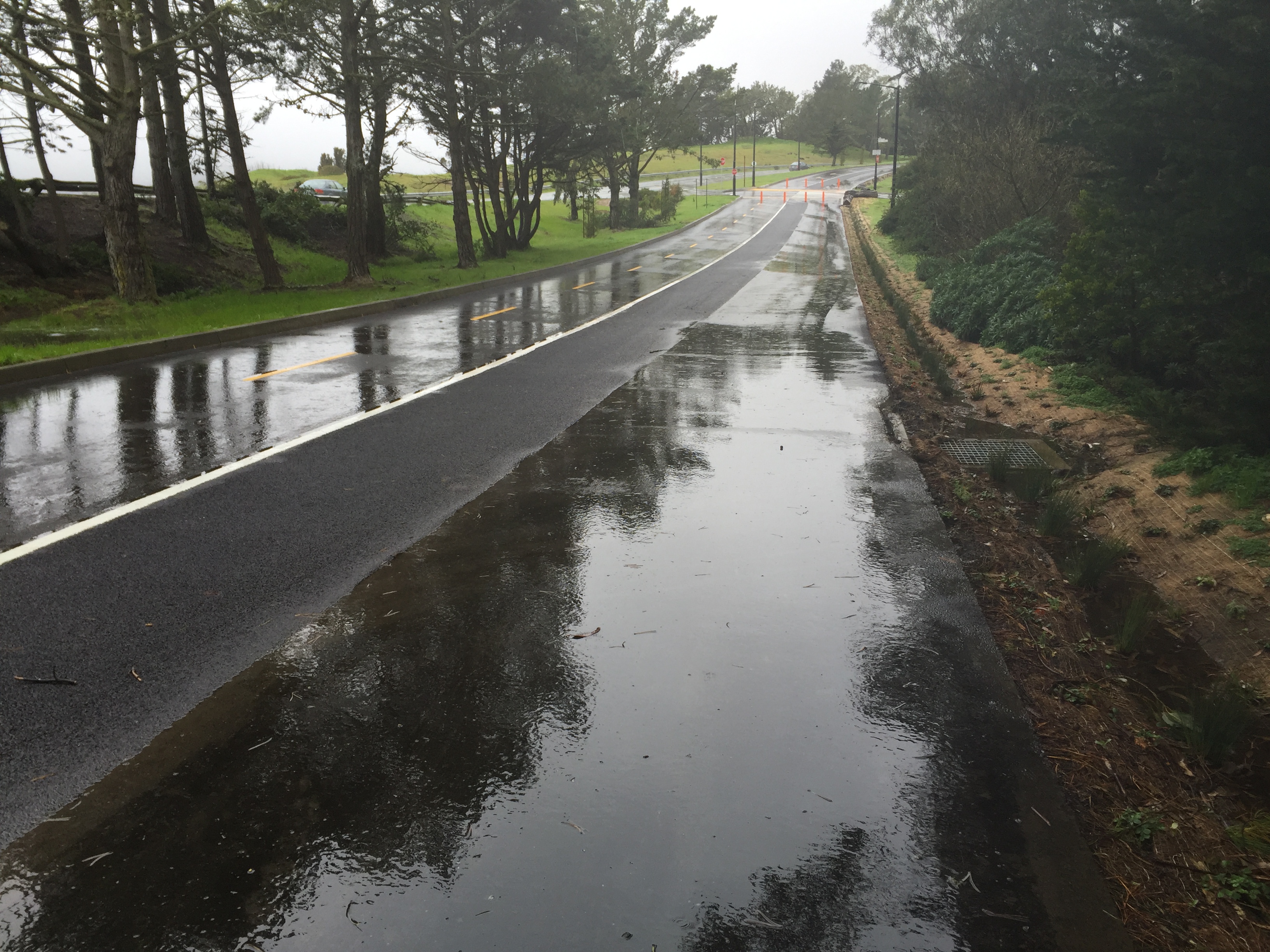
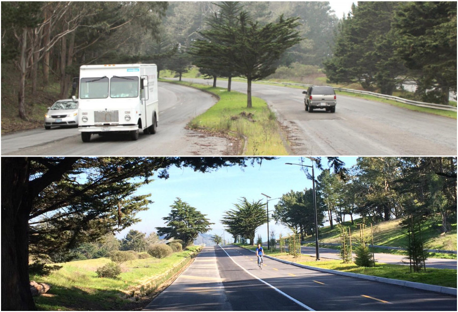
Mansell Street was conceived in the 1950’s as part of a never-completed cross-town freeway. By design, Mansell Street primarily served motorized vehicles. The width of the traffic lanes and three different speed limits posted encourage speeding. Pedestrians had to walk on the street or climb over a guard rail and walk along an informal path to access different park facilities or to commute between neighborhoods. Bicyclists also had to share the road with vehicles travelling at speeds up to 45 MPH, and public transit users had to wait on the street for a bus. Mansell Street from University Street to Brazil Avenue, and continuing onto Persia Avenue to Dublin Street. The Mansell Streetscape Improvements Project addressed pedestrian safety and bicycle access issues by reducing the number of vehicular lanes from four to two (one lane each way), separating vehicular traffic and moving it to the south side of the median between Visitacion Avenue and Brazil Street, and creating a multiuse path on the north side of the median. The project included the construction of a sidewalk along the south side of Mansell Street from Shelly Drive West to Brazil Avenue, and class II and III bicycle facilities between Brazil Avenue and Dublin Street. Safety improvements included raised crosswalks and flashing beacons at some intersections and a corner bulb-out at the intersection of Persia Avenue and Sunnydale Avenue. Street-level lighting, trees and landscaping, and site furnishings were also included to make this a complete streets project. The jogging path was also paved with pervious asphalt to help reduce runoff and to keep the path dry for runners during rain events.
Add Comment