Telegraph Avenue Paving and Lane Conversion Project
Location
Telegraph Avenue between 42nd and 52nd Streets
City or County Responsible for Project
Santa Ana
Author
Sarah Fine
City of Oakland
1 Frank H. Ogawa Plaza, Oakland, CA 94612
(510) 444-CITY
Project Description
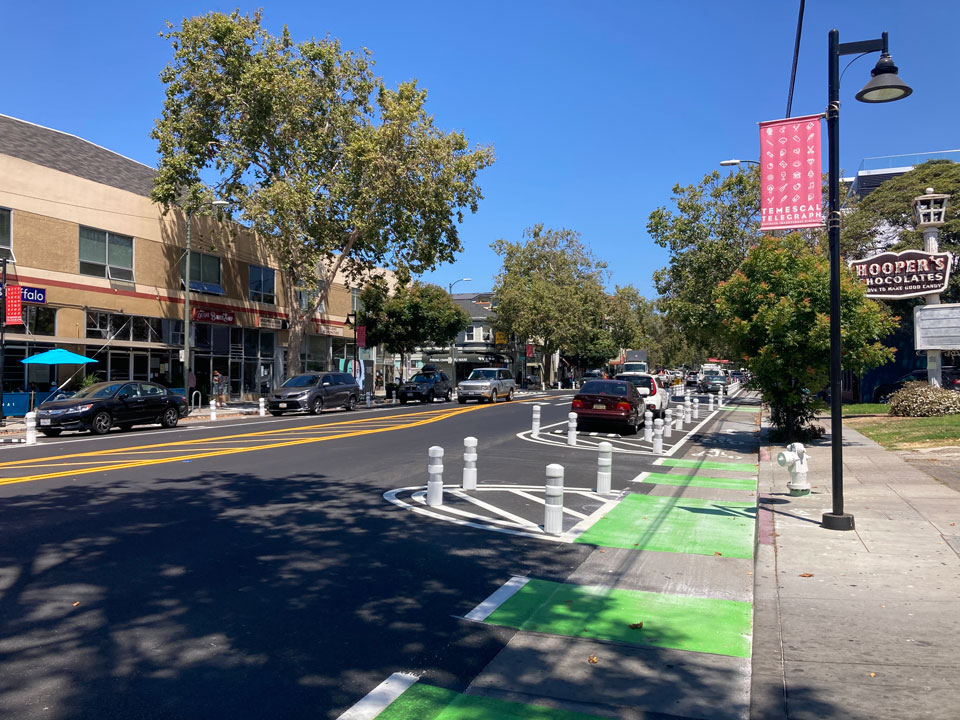
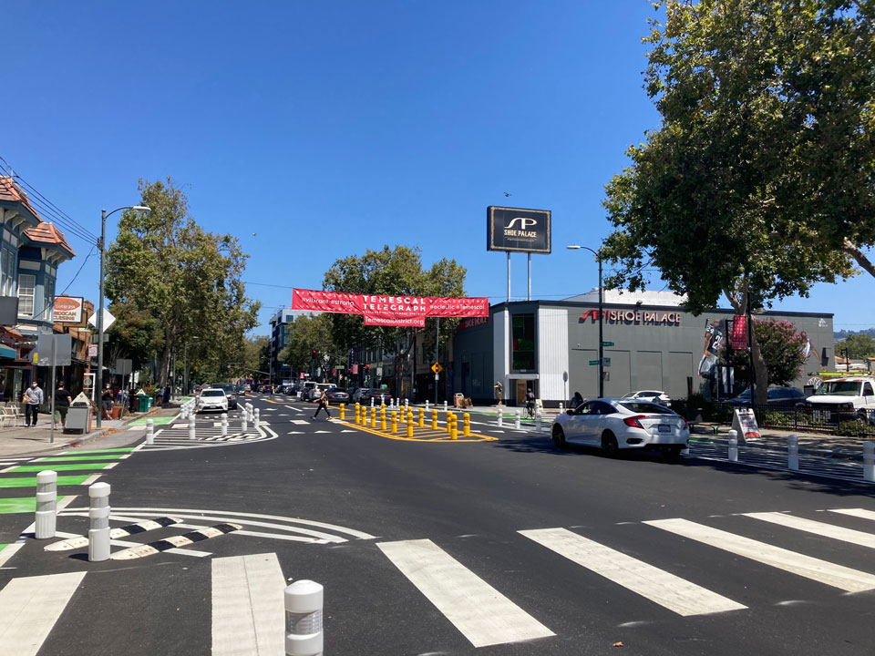
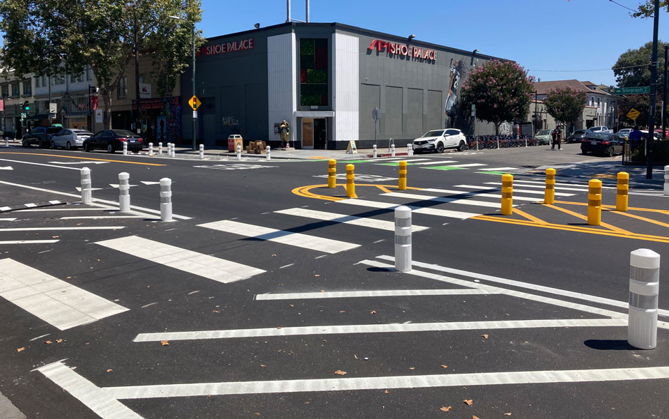
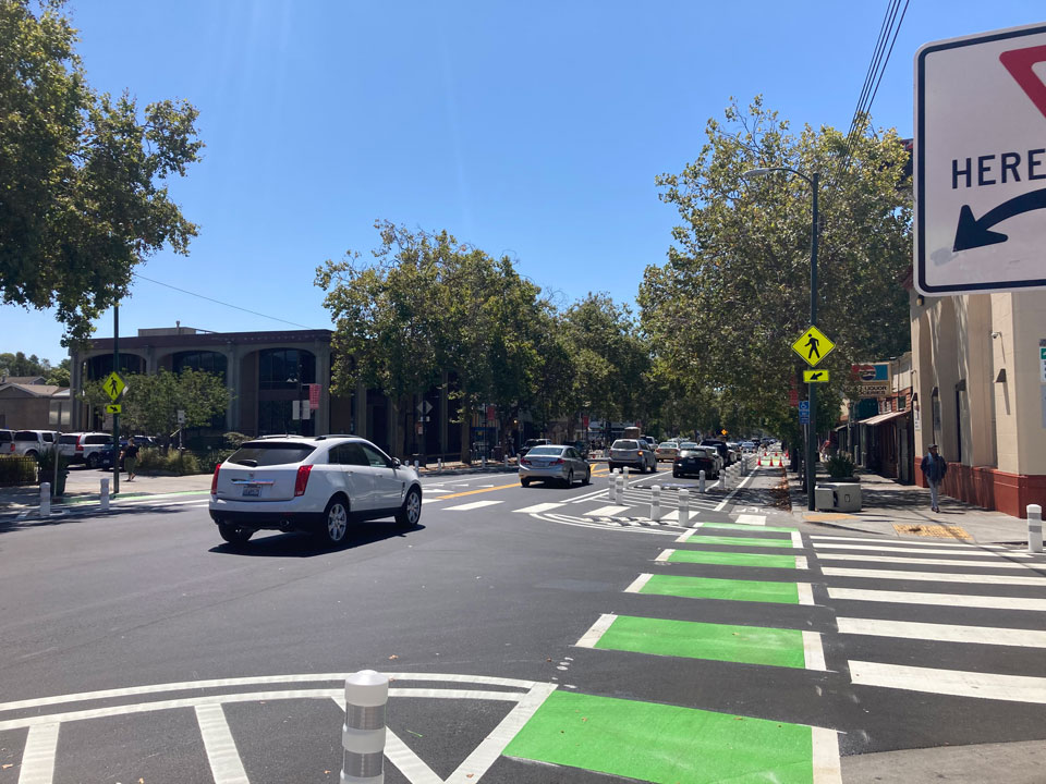
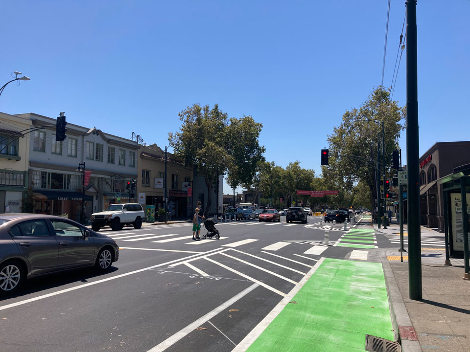
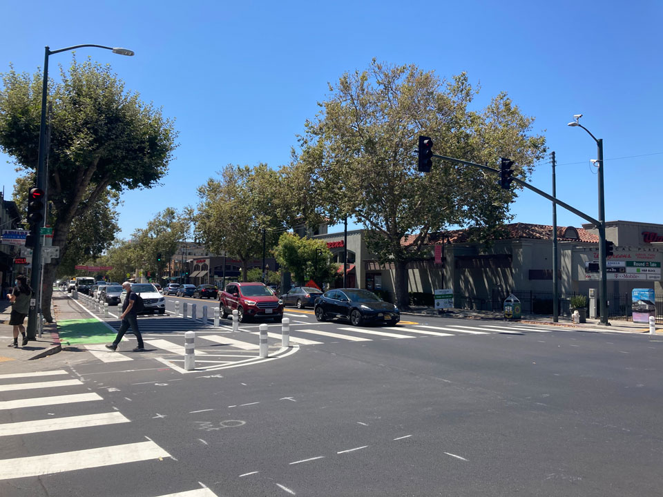
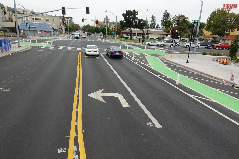
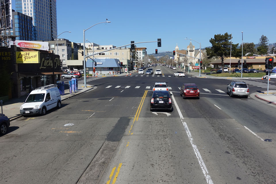
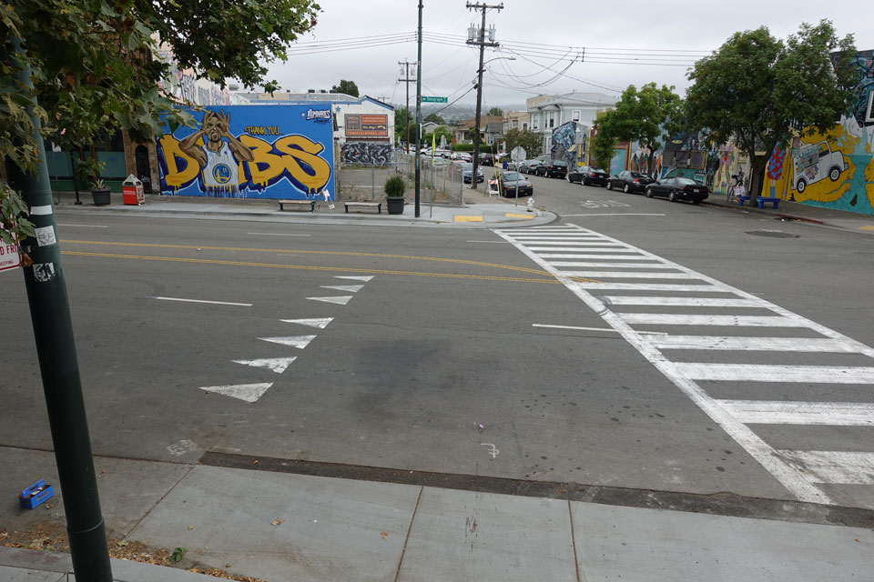
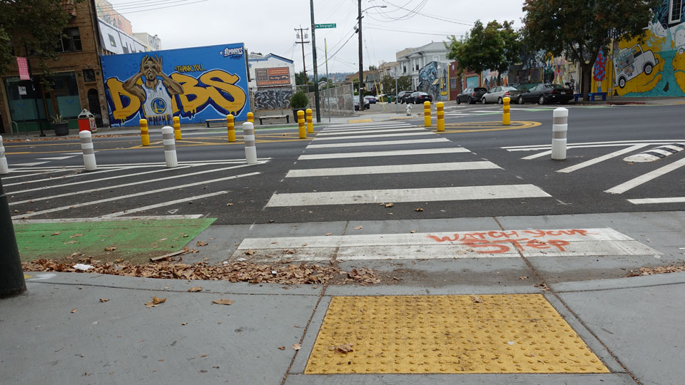
Telegraph Avenue is a 4.5-mile street that begins in the historic downtown district of Oakland, Calif., and ends at the southern edge of the University of California, Berkeley. Between 42nd and 52nd Streets, the busy corridor is home to numerous businesses, shops, restaurants and residences within the Temescal District commercial area and sees heavy auto, bike and foot traffic daily, making it a center of community life. However, the area was plagued by tight streets, huge dents that pockmarked the length of the corridor and a long history of tragic crashes, making conditions unsafe for pedestrians, bikers and drivers alike. After a decade of shelved plans to improve conditions on Telegraph Avenue coupled with conflicting opinions from key stakeholders on the future of the avenue, a change was needed. Throughout the project, Telegraph Avenue was transformed through an innovative combination of a road diet – or reduction in travel lanes or width of the road to achieve systemic improvements – and implementation of complete streets – or streets that designed and operated to enable safe access for all users, including pedestrians, bicyclists, motorists and transit riders of all ages and abilities. The major improvements on Telegraph Avenue between 42nd and 52nd Streets consisted of improving intersection design, installing crosswalk enhancements, bulb-outs, median refuges, Americans with Disability Act (ADA) compliant curb ramps and Rectangular Rapid Flashing Beacons (RRFBs) and a road diet with bicycle lanes.