Safe Streets for 17th Street and Michigan Avenue
Location
17th St from Wilshire Blvd to Pico Blvd; Michigan Ave from 14th St to 20th St
City or County Responsible for Project
Santa Monica, CA
Category
Complete Streets Projects
Description
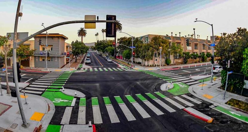
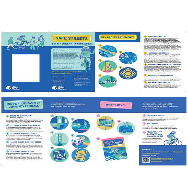
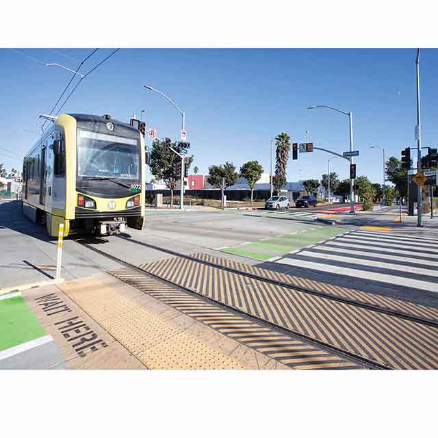
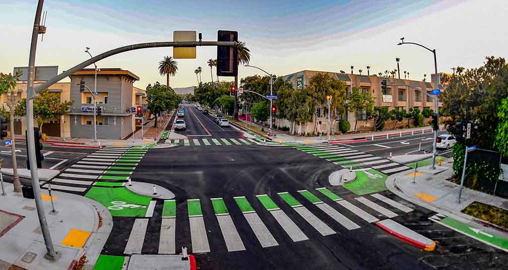
Since the opening of the Metro Expo (E) Line in 2016, 17th Street has experienced a large increase in pedestrian and bicycle traffic. The Safe Streets for 17th Street and Michigan Avenue Project was designed to improve bike and pedestrian safety and promote sustainability to combat climate change. The 1.5-mile project features curb-protected bike lanes, with a section raised at sidewalk level, Dutch-style intersections, mini traffic circles, leading pedestrian intervals (LPIs), curb extensions, pedestrian scale lighting, a red-painted bus zone, and a newly resurfaced roadway. The project connects to the Metro E Line 17th St/SMC Station, Santa Monica College (SMC), the Expo bike path, Memorial Park, schools, bike lanes on Arizona Avenue and Broadway, and the Michigan Avenue Greenway and marks a crucial step towards advancing the city’s key strategic priority of fostering a sustainable and connected community.
The project builds upon foundational city initiatives rooted in deep community engagement and feedback including the adopted Bike Action Plan Amendment, Pedestrian Action Plan, the Michigan Avenue Neighborhood Greenway (MANGo) Plan, and the city’s Land Use and Circulation Element.
In addition to promoting sustainability and multi-modal transportation, Safe Streets for 17th Street and Michigan Avenue advances the city’s commitment to a Clean and Safe Santa Monica, including the Vision Zero initiative, which is the goal of eliminating severe traffic injuries and deaths on city streets. The project was funded using a combination of federal and local funds.
Project submitted by
Jacqui Swartz
Senior Transportation Planner
City of Santa Monica
1685 Main St, Mail Stop 38 Santa Monica, CA 90401
jacqui.swartz@santamonica.gov
3104588955