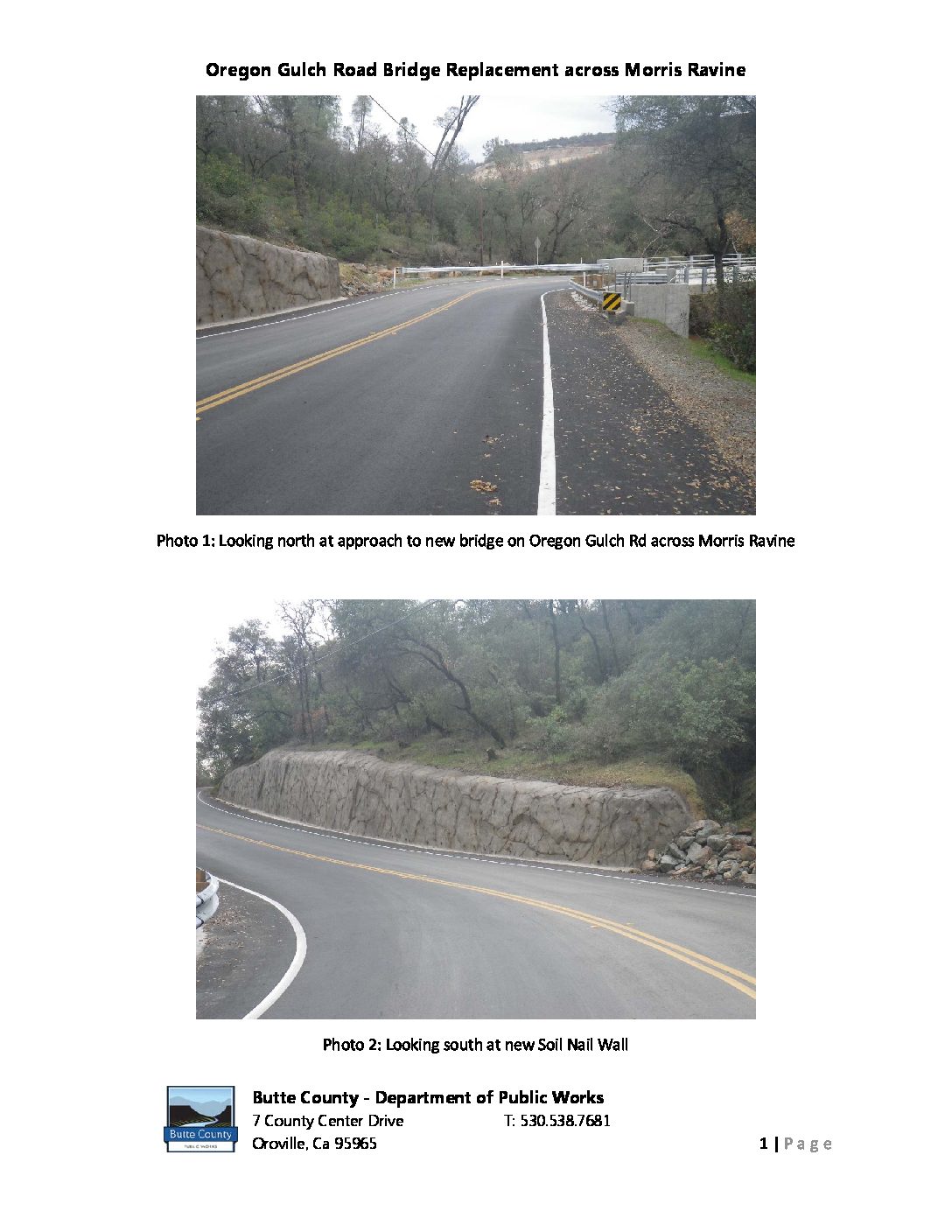
Oregon Gulch Road Bridge Replacement across Morris Ravine
Location Oregon Gulch Road, 0.1 miles east of Cherokee Road City or County Responsible for Project Butte County Category Bridge: Efficient and Sustainable Bridge Maintenance, Construction and Reconstruction Projects Author Raymond Cooper Organization Butte County Public Works Address 7 County Center Drive, Oroville, CA 95965 Phone 530-538-7681 Project Description Butte County Oregon Gulch Road Bridge Replacement across Morris Ravine This project is a bridge replacement funded through the Federal Highway Bridge Program (HBP) in conjunction with the Off Federal-aid System (OFS) Highway Bridge Program. In general, the project involved the replacement and the subsequent removal of an existing bridge. The new bridge, completed in the fall of 2017 was constructed on a new alignment immediately adjacent and just downstream of the previous crossing. This allowed local traffic to be preserved throughout construction. The new bridge is a single-span pre-stressed cast-in-place reinforced concrete slab type highway bridge approximately 70 feet in […]