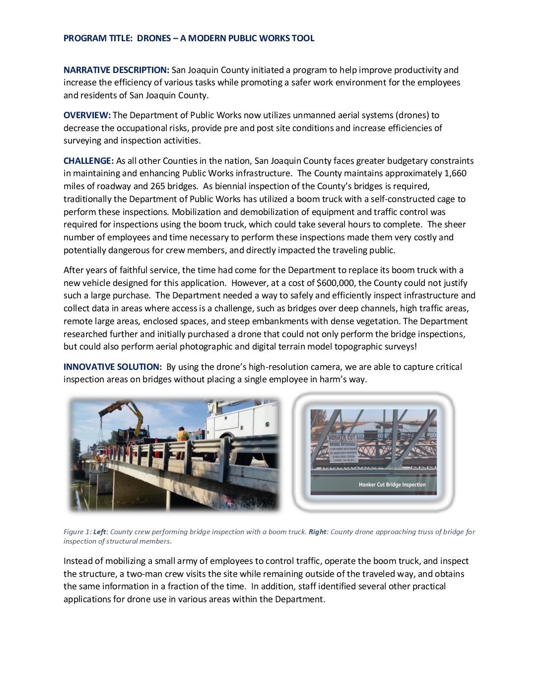
East Fork Road Bridge over North Fork San Gabriel River Project
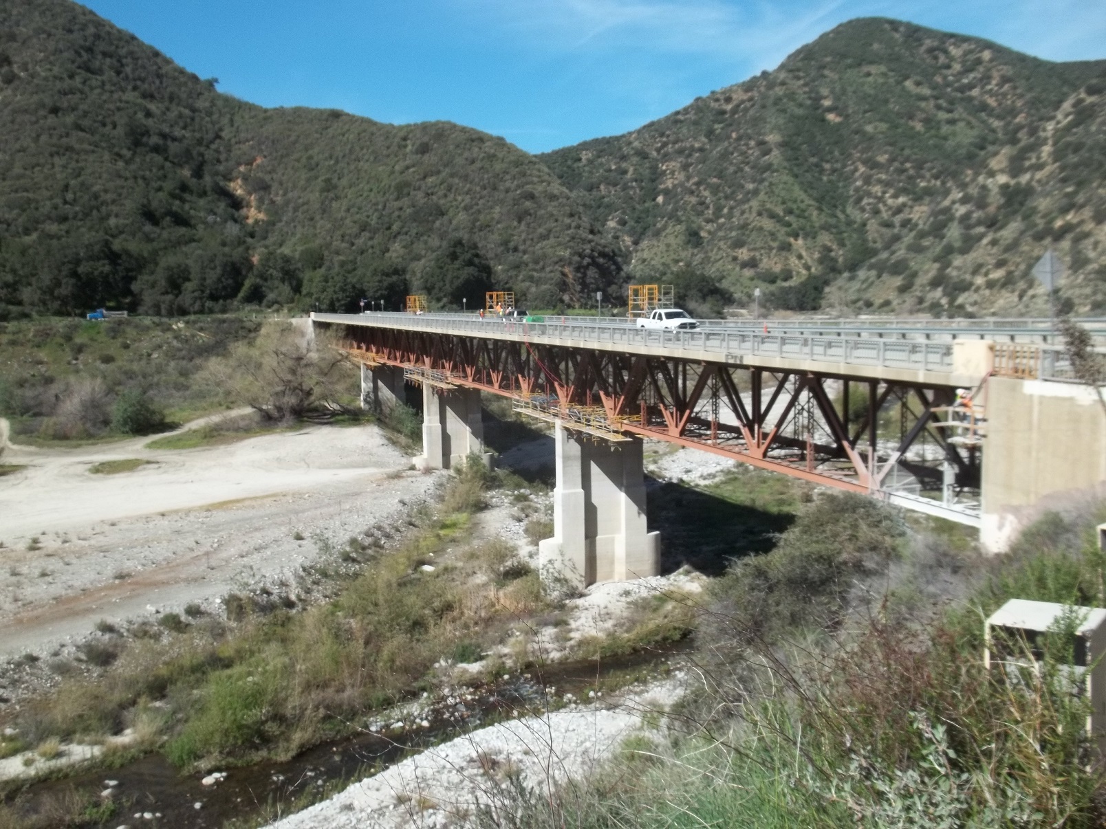
Location In the San Gabriel Mountains, Los Angeles County City or County Responsible for Project Los Angeles County Category Bridge: Efficient and Sustainable Bridge Maintenance, Construction and Reconstruction Projects Author Leslie Schenk Organization Los Angeles County Department of Public Works Address 900 South Fremont Avenue, Alhambra, CA 91803 Phone (626) 458-5946 Project Description The East Fork Road Bridge over North Fork San Gabriel River Project (Project) is a 642-feet long, steel truss bridge built in 1949. It is located in the San Gabriel Mountains National Monument just north of the City of Azusa and provides access to Los Angeles County Fire facilities and recreational amenities such as the East Fork Trail that leads to the “Bridge to Nowhere”. The Project consisted of seismically retrofitting the bridge to prevent collapse after an earthquake. It demonstrates a high level of complex structural engineering and innovative use of technology. Respecting the environment and […]